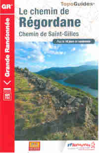
240 km (150 miles) of path between Le Puy-en-Velay (Haute-Loire) and Saint-Gilles-du-Gard (Gard) are awaiting for you along the Regordane way. Track of merchants and mule-drivers, track of pilgrims going to the tombstone of Saint-Gilles or towards the Black Madonna of le Puy-en-Velay, it has also been an epic path, field of the exploits of William of Orange releasing Nîmes from theSaracens. You will walk in the rut created in the rock by the repeated passing of the wagons, towards the castle of Portes or the fortified village of La Garde-Guérin, which sheltered the “pariers” knights, in charge of the security along the way.
Warning! A diversion is in progress on this GR: see the page about the diversions on the GR of Haute-Loire.
The Topoguide (guide book) of the Regordane Way GR® 700, includes all the information required to prepare your walking itinerary. You will found advice about the equipment, nutrition, weather but also useful information about the transport in the region, accommodation and other service along the way.
The guide book also includes IGN maps, the detailed route from Le Puy-en-Velay to Saint-Gilles-du-Gard and a precise description of the way. The mileage and indicative times of walking between each locality are also defined. Some thematic texts (geology, heritage, landscapes, and tourism) will allow you to walk while discovering the richness of the regions crossed by the GR® 700, Regordane Way.
This itinerary is in the heart of great movements of antique and medieval history. One used id to join the Île-de-France to the Mediterranean. In about 10 days, from Le Puy-en-Velay towards Saint-Gilles-du-Gard, by Langogne, La Garde (Guerin, Alès or Nîmes, the walker takes a millennium track dug ruts (kind of rails dug in the rock to guide the wagons), marked out by “montjoies” (pile of stones staked to mark the paths), by dolmens and rupestrian writings.
Step by step, the walker discover the history of the flow of men, merchandises but also ideas. This path indeed carries the tracks of struggle for the freedom of awareness: Arianism, Catharism and Protestantism have developed there. The landscape is of a great richness: forest of resinous trees, pastures of thick grass and lava flows in the North gradually give way to sweet chestnut trees and brooms, to green oak-trees then to the garigue, as the “Petite Camargue” approaches (“Petit Camargue” designates the part of the Camargue situated at the West of the Petit-Rhône, in the region of Gard).


Existe-t-il des possibilités de rejoindre Saint-Gilles-du-Gard au Puy-en-Velay pour récupérer sa voiture? Merci à l’avance de votre réponse Bernard
Bonjour,
Afin d’organiser votre retour, nous vous conseillons de consulter le page 9 du Topoguide du GR700 Chemin de Régordane, où sont mentionnées toutes les possibilités de retour par avion, train, bus, taxi… Sinon, vous pouvez également faire appel à un Transporteur, tel que notre partenaire La Malle Postale. Vous retrouverez tous nos prestataires sur notre page dédiée : https://www.rando-hauteloire.fr/organiser/transporteurs-et-services/
Cordialement.
Bonjour, existe-t-il des hébergements religieux sur le chemin de Saint Gilles ? Merci
Bonjour,
Je ne pense pas, je vous conseille de leur demander si vous réservez mais aucun n’est enregistré comme étant religieux.
Mélissa
Bonjour tout le long du chemin est il possible de randonner avec son ane et aussi trouver un hébergement adapté pour mon ane
Bonjour, vous pouvez randonner tout le long du chemin de Régordane avec un âne. Sur le guide des hébergements, les hébergeurs précisent en général s’ils acceptent les ânes ou non. Sinon en les appelant ils vous le diront. Mélissa
Bonjour je propose 2 hébergements en gîte 2 fois 8 personnes.35 euros par nuit par personne situé à Lesperon gite des peyreyres.cordialement. franck
Bonjour,
Pour votre référencement merci de voir avec le Comité Départemental de Randonnée de l’Ardèche ainsi que l’Office de Tourisme de votre secteur.
Bonne journée.
bonjour
impossible de trouver un topo pour Régordane, car il est épuisé… Auriez-vous une piste pour en trouver un ?
Merci d’avance, bien cordialement
Bonjour,
Vous pouvez vous procurer le Topoguide du Chemin de Régordane sur notre boutique en ligne : https://www.rando-hauteloire.fr/la-boutique/en-ligne/ dans l’onglet “Autres Grandes Randonnées” ou à la Croisée des Chemins notre boutique en ville au Puy-en-Velay.
Bonne journée.
Est-il possible de faire le chemin de la régordane en VAE? Faut-il prendre des routes sur certaines portions trop difficiles et lesquelles?
Bonjour,
S’agissant d’un itinéraire pédestre, il nous est compliqué de vous répondre…
Vous pouvez vous rapprocher des Office de Tourisme pour plus de détails sur chaque territoire traversé.
Bonne journée.
Bonsoir,
Nous souhaiterions faire la partie Alès – St Gilles en 4 jours
Le topo guide n’étant plus disponible quelqu’un pourrai-il me conseiller pour des étapes à peu près égales en km.
Merci de votre aide
Bonjour,
Vous pouvez trouver le topoguide sur notre boutique en ligne et ainsi construire vos étapes comme vous le souhaitez.
Bonne journée.
Bonjour peux t on randonnée sur le gr700 avec un chariot de randonnée ? Merci Cordialement
Bonjour,
Cela parait envisageable sur certaines portions mais nous ne pouvons pas vous l’assurer sur la totalité du GR.
Bonne journée.
Bonjour, est-il possible de faire cette randonnée avec un chien ?
Bonjour,
Sur la partie Haute-Loire oui sans aucun problème, par la suite et notamment avec la traversée du Parc National des Cévennes nous vous recommandons de voir avec eux pour la réglementation mise en place.
Bonne journée.